
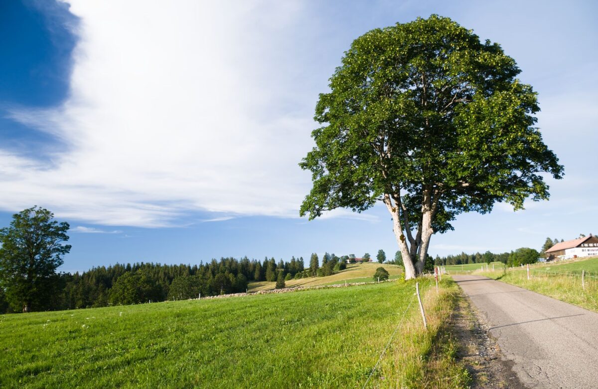
CRZ, Forest and Hill-Zone Checks Near Pali
Buyers often ask about CRZ first when they look at land restrictions near Pali – but Pali sits in the inland Sahyadri foothills, where CRZ usually does not reach. The checks that actually bite here are forest, hill-slope and river-buffer rules.
- CRZ is a coastal rule. It applies within 500 m of the sea’s High Tide Line and along tidal creeks and rivers – so it rarely touches inland foothill plots near Pali, though a tidal stretch can extend it, so confirm per plot.
- Pali is in Sudhagad taluka, inland Sahyadri foothills with the Amba river and forts nearby – Konkan plains and the coast lie to the west.
- The restrictions that matter here are usually forest and tree-cover, hill-slope and gradient, and river-buffer or flood-line rules.
- These run through the Forest Department, the Collector/Town Planning and UDCPR 2020 under the Raigad Regional Plan – not a single office.
- Rules and boundaries vary by survey; verify every specific on the ground and on record before you assume a plot is buildable.
What land restrictions near Pali actually apply, and which do not?
The land restrictions near Pali that most often apply are forest and tree-cover rules, hill-slope and gradient limits under UDCPR 2020, and river-buffer or flood-line setbacks along the Amba and its tributaries. Coastal Regulation Zone (CRZ) rules, by contrast, usually do not apply this far inland, because Pali sits in the Sahyadri foothills rather than on the tidal coast.
It helps to sort the landscape into “almost certainly relevant” and “probably not, but confirm”. Pali is in Sudhagad taluka, Raigad – inland hill-and-valley country around the Amba river, below forts like Sarasgad and Sudhagad, with the Konkan plains and the Arabian Sea some distance to the west. In that setting, the overlays that commonly limit where and how you build are forest land status, hill-slope gradient, and no-development buffers along watercourses.
CRZ belongs to a different geography. It is a coastal protection regime, and the places in Raigad where it dominates land decisions – Alibaug, Pen, the creekside belts – are nearer the sea. For a plot in the foothills near Pali, CRZ is usually a question you can close quickly, but only after you confirm there is no tidal creek or river stretch nearby that pulls the plot into it.
Does CRZ apply to land near Pali?
Usually not. CRZ applies to land within 500 m of the sea’s High Tide Line and to a defined buffer along tidal-influenced creeks, rivers and backwaters. Pali’s foothill plots sit inland, away from tidal influence, so CRZ typically does not govern them – but because tidal reaches of rivers can extend the zone, you should still confirm there is no CRZ overlay for the specific survey.
The reason for the confusion is that buyers hear “Raigad” and “river” and assume CRZ. But CRZ is triggered by tidal action, not by water in general. The notification covers coastal stretches and the landward side of tidal creeks, rivers and backwaters up to a set distance from the High Tide Line. A freshwater foothill stream well above the tidal limit is not CRZ land.
What forest and tree-cover checks matter near Pali?
Near Pali you should check whether any part of the plot is reserved, protected or private forest, whether it falls in an eco-sensitive zone around a protected area, and what permission tree-felling needs. Forest land cannot be freely bought or built on, and land once recorded or notified as forest carries restrictions even if it looks like an ordinary field today.
This is the check most likely to surprise a buyer in hill country. Land can be forest for legal purposes in several ways: it may be recorded as reserved or protected forest, it may have been notified as private forest under the relevant acquisition law, or it may meet the broad judicial understanding of “forest” regardless of ownership. Any of these sharply limits what you can do, and clearing trees without permission is an offence in its own right.
- ✓Forest status. Confirm with the Forest Department and revenue records that no part of the plot is reserved, protected or private forest.
- ✓Eco-sensitive zone. Check whether the plot falls within a notified eco-sensitive zone buffer around any protected area or sanctuary.
- ✓Tree-felling. Understand what permission is needed before removing trees, even on private land.
- ✓7/12 land-use. Read the 7/12 extract for any forest, grazing or similar notation on the survey.
How do hill-slope and gradient rules affect building near Pali?
Under UDCPR 2020, land on steeper gradients in hilly areas faces reduced development potential and, above defined slopes, restrictions or prohibitions on construction, with special provisions for drainage, retaining structures and reduced FSI. On foothill plots near Pali, the slope of the land can quietly decide how much of it you can actually build on.
A sloping plot with a valley view is part of the appeal here – and also part of the regulation. The development control rules treat hilly and steeply sloping land differently from flat land, with graded limits that tighten as the gradient rises; beyond a certain steepness, development may not be permitted at all. The practical effect is that a plot’s buildable area can be smaller than its total area, and the cost of building safely on a slope – cutting, retaining walls, drainage – is higher.
Because the exact gradient bands and what they allow depend on the current UDCPR provisions and the authority’s reading of the site, treat any slope as something to measure and verify, not eyeball. A plot that photographs beautifully from the road may carry meaningful slope restrictions once surveyed. For the UDCPR framework that governs this, see the state’s development control regulations and confirm the current rules for your plot.
What river-buffer and flood-line restrictions apply near the Amba river?
Land along the Amba river and its tributaries near Pali can carry a no-development buffer and flood-line (blue and red line) restrictions, which keep construction back from the watercourse and out of the flood-prone band. These setbacks are set under the Regional Plan and UDCPR and are separate from CRZ, which is coastal.
The Amba runs by Pali and is one of the belt’s attractions, but a riverside plot comes with its own line-work on the planning maps. Flood lines mark the extent of expected flooding and a buffer along the bank within which building is restricted or prohibited, so that homes stay out of the river’s reach and the bank stays stable. A plot that includes land inside these lines will have less usable, buildable area than its paper extent suggests.
Keep this distinct from CRZ in your head: CRZ is about tidal, coastal water; river buffers and flood lines are about freshwater flooding and bank protection, and they apply inland. Both can take land off the table, but through different authorities and maps. Confirm the flood line and any river buffer for a riverside plot with the Town Planning or irrigation authorities before you value it.
How do you check land restrictions near Pali before you buy?
To check land restrictions near Pali, read the 7/12 and land-use notation, confirm forest and eco-sensitive-zone status with the Forest Department, verify CRZ status (usually inapplicable inland but confirm), measure the slope against UDCPR hill-area rules, and obtain the flood line and river buffer for riverside plots – ideally through a local advocate and licensed surveyor.
| Restriction | Where to confirm it |
|---|---|
| Forest / private forest | Forest Department + revenue records |
| Eco-sensitive zone | Notified ESZ maps for nearby protected areas |
| CRZ (usually coastal only) | CRZ maps / authority for the survey |
| Hill-slope / gradient | Licensed surveyor + UDCPR 2020 rules |
| River buffer / flood line | Town Planning / irrigation flood-line maps |
No single office holds all of these answers, which is why a buyer who relies on a seller’s assurance is taking the biggest risk on this list. Commission the title and land-use search, get the plot physically surveyed, and ask each relevant authority in writing. The cost of that diligence is small against the cost of discovering, after purchase, that half your plot is forest, flood-line or un-buildable slope.
And remember the corridor’s two-regime split: Pali and Sudhagad fall under the Raigad Regional Plan and UDCPR 2020, a different framework from the NAINA/MSRDC side near Khopoli. The restriction maps and approving authorities follow the survey, so confirm which apply to your exact plot. None of this guarantees a plot’s future value – it only tells you what you can lawfully do with the land.
FAQ
Does CRZ apply to land near Pali?
Usually not. CRZ applies to land within 500 m of the sea’s High Tide Line and to a defined buffer along tidal-influenced creeks, rivers and backwaters. Pali’s foothill plots sit inland, away from tidal influence, so CRZ typically does not govern them, but because tidal reaches of rivers can extend the zone, you should still confirm there is no CRZ overlay for the specific survey.
What land restrictions actually apply near Pali?
The restrictions that most often apply near Pali are forest and tree-cover rules, hill-slope and gradient limits under UDCPR 2020, and river-buffer or flood-line setbacks along the Amba and its tributaries. CRZ, a coastal rule, usually does not apply this far inland because Pali sits in the Sahyadri foothills rather than on the tidal coast.
What forest checks matter near Pali?
Check whether any part of the plot is reserved, protected or private forest, whether it falls in an eco-sensitive zone around a protected area, and what permission tree-felling needs. Forest land cannot be freely bought or built on, and land once recorded or notified as forest carries restrictions even if it looks like an ordinary field today. Confirm with the Forest Department and revenue records.
How do hill-slope rules affect building near Pali?
Under UDCPR 2020, land on steeper gradients in hilly areas faces reduced development potential and, above defined slopes, restrictions or prohibitions on construction, with special provisions for drainage, retaining structures and reduced FSI. On foothill plots near Pali the slope can make the buildable area smaller than the total area, so measure and verify it rather than eyeball it.
Are there river-buffer or flood-line restrictions near the Amba river?
Yes, land along the Amba river and its tributaries near Pali can carry a no-development buffer and flood-line restrictions that keep construction back from the watercourse and out of the flood-prone band. These setbacks are set under the Regional Plan and UDCPR and are separate from CRZ, which is coastal. Obtain the flood line and buffer for a riverside plot before valuing it.
How do you check land restrictions near Pali before buying?
Read the 7/12 and land-use notation, confirm forest and eco-sensitive-zone status with the Forest Department, verify CRZ status (usually inapplicable inland but confirm), measure the slope against UDCPR hill-area rules, and obtain the flood line and river buffer for riverside plots. No single office holds all these answers, so use a local advocate and a licensed surveyor and ask each authority in writing.
Lords of the Lands is developing a plotted project on the Khopoli-Pali road, and our team works through forest, slope and flood-line checks survey by survey. If you are weighing a plot near Pali, we can help you confirm what actually applies to it.
Related reading
On the Khopoli-Pali road
- The complete Khopoli-Pali road land guide – the SH-93 corridor hub
- Khopoli vs Pali land – which end of the road suits you
- Khopoli-Pali land prices in 2026 – the asking bands by village
- A weekend home on the Khopoli-Pali road – building a second home here
- Khopoli to Pali drive times – how long each leg really takes
- Pali land in 2026 – buying in Sudhagad taluka
- Buying land in Pali and Sudhagad – a step-by-step guide
- The villages along the Khopoli-Pali road – a village-by-village look
- The Khopoli-Pali road in 2030 – what is coming next
- Mumbai to Khopoli-Pali – the route and drive time
Legal & approvals
- NA conversion on the Khopoli-Pali road – turning farmland buildable
- Building permission on a Khopoli-Pali plot – the approval route
- Which authority approves your plot – NAINA vs the Raigad plan
- Varg-1 vs Varg-2 land in Raigad – freehold vs restricted tenure
- Plotted-layout checks on the road – layout and RERA checks
- What NA land actually means – non-agricultural status explained
- How to check a plot’s NA status – confirming it is buildable
- How to verify land title – the title search explained
Infrastructure & nearby markets
- Mumbai 3.0 infrastructure in 2026 – the projects reshaping the region
- How NMIA is reshaping Raigad land – the new airport’s land effect
- Atal Setu and Raigad land – the sea link’s reach into Raigad
- Navi Mumbai airport status – where operations stand
- The Expressway Missing Link and Khopoli – the ghat bypass explained
- Khopoli land in 2026 – the Expressway-end town
- Khalapur land in 2026 – the taluka around Khopoli
- Karjat land prices in 2026 – the neighbouring market
Citations and sources
Coastal Regulation Zone (CRZ) applies to coastal stretches and tidal-influenced creeks, rivers and backwaters up to 500 m from the High Tide Line – CRZ Notification, Ministry of Environment, Forest and Climate Change. Forest land and tree-cover restrictions – Indian Forest Act, Maharashtra private-forest law and the judicial understanding of “forest”, Forest Department. Hill-slope/gradient and river-buffer/flood-line development controls – UDCPR 2020, Urban Development Department, and the Raigad Regional Plan (notified 1991). Pali is in Sudhagad taluka, inland Sahyadri foothills. All overlays and boundaries vary by survey – verify forest, ESZ, CRZ, slope and flood-line status for the specific plot with the relevant authorities. This is general information, not legal advice – confirm every restriction independently before you transact. Official sources: UDCPR / Urban Development Dept · Maharashtra Govt (Revenue & Forest) · Bhulekh Mahabhumi (7/12, property card).
