
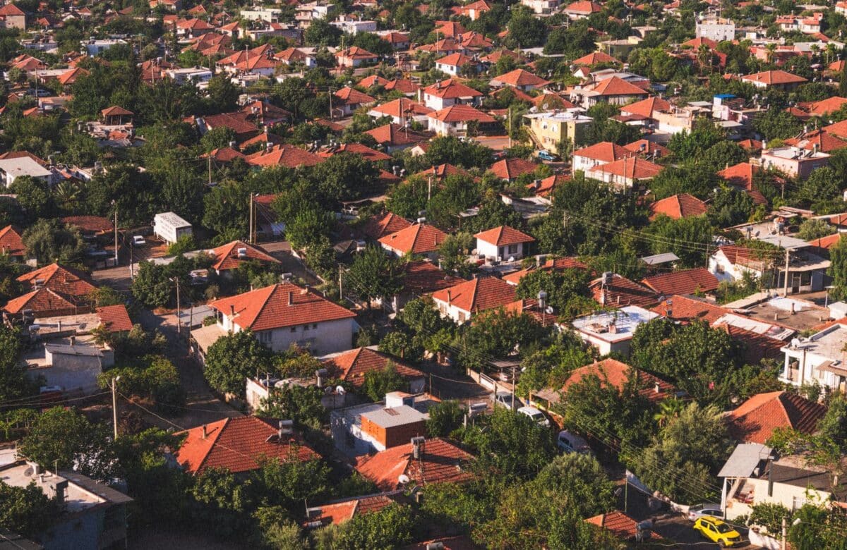
Karjat vs Khopoli vs Alibaug vs Shrivardhan: Which?
- Karjat is inland, ~62 km from Mumbai (~1 hr 15 min in light traffic), and its own dedicated infra trigger — the Panvel–Karjat suburban rail corridor — was ~99% complete, targeted to open around Diwali 2026 (UNI India, 22 Sep 2026), pending Commissioner of Railway Safety clearance.
- Khopoli is inland, ~71.5 km from Mumbai, sitting at the foot of the Mumbai–Pune Expressway Missing Link, which opened 1 May 2026 and cuts the expressway climb by 25–30 minutes.
- Upper Alibaug is coastal, ~95 km from Mumbai via the Atal Setu (MTHL), open since 12 January 2024 — road travel is now ~2 hrs–2 hrs 15 min, and the under-construction Revas–Karanja bridge (targeted March 2028) will later cut Uran–Alibaug from ~70 km/2+ hrs to ~30 km/30 min.
- Shrivardhan is coastal and the furthest at ~185 km from Mumbai via NH66 (nearest rail station Mangaon, 45 km away); its infra trigger, the Agardanda Creek Bridge, started construction in early 2025 on a 30-month build.
- CRZ applies to Upper Alibaug and Shrivardhan (coastal talukas, regulated from the High Tide Line); it does not apply to Karjat or Khopoli (inland, no coastline).
- If your shortlist is Karjat vs Khopoli land, the practical difference is lifestyle/nature demand (Karjat) versus expressway-anchored access and scale (Khopoli) — not appreciation, which this post does not claim for either.

Which corridor fits which investor — the short answer
Match the corridor to what you actually want to hold: Karjat for nature-led weekend/second-home land, Khopoli for expressway-anchored scale plots, Upper Alibaug for coastal lifestyle land with the shortest drive time of the two coastal options, and Shrivardhan for early-stage coastal land at the corridor’s current edge of infrastructure.
None of these is a universal “best” — MahaRERA and the Real Estate (Regulation and Development) Act prohibit guaranteed-return claims, and this post makes none. What follows is a like-for-like comparison of five public, checkable facts per corridor: distance/travel time, the corridor’s named infrastructure trigger and its current status, whether the Coastal Regulation Zone applies, the taluka’s ready-reckoner position, and the land’s typical current use. Every figure below is dated and sourced — check each against its source before you rely on any of it, and re-verify infra status close to your purchase date, since construction timelines move.
Karjat vs Khopoli vs Alibaug vs Shrivardhan, compared (September 2026)
A side-by-side table beats prose for this question, because “which corridor” is a comparison, not a story — MahaRERA compliance also means a claim like “Khopoli is growing faster than Karjat” needs a metric attached, not an adjective.
The table below uses only metrics with a public, checkable source: government/PWD-adjacent infrastructure trackers, Wikipedia geography (cross-checked against the district’s own boundary description), and the CRZ Notification 2019 text itself.
| Corridor | Distance from Mumbai / travel time | Key infra trigger | Trigger status (Sep 2026) | CRZ exposure | ASR band, ₹/sq m (FY2026-27)¹² | Typical current use |
|---|---|---|---|---|---|---|
| Karjat | ~62 km road; ~1 hr 15 min at free-flow speed, more in traffic¹ | Panvel–Karjat suburban rail corridor (MUTP-III, 5 new stations)³ | ~99% complete; targeted to open around Diwali 2026, pending Commissioner of Railway Safety clearance³ — confirm live status before relying on it | None — inland taluka, no coastline⁸ | 6,920–13,700¹² | Weekend/second homes, nature and wellness-led plots, boutique hospitality |
| Khopoli | ~71.5 km road; ~1 hr 20 min at free-flow speed, more in traffic² | Mumbai–Pune Expressway “Missing Link” (Khopoli–Kusgaon bypass)⁴ | Open — inaugurated 1 May 2026; cuts the ghat climb by ~6 km / 25–30 min⁴ | None — inland taluka, no coastline⁸ | 6,730–9,930¹² (Khalapur taluka) | Expressway-anchored plotted layouts, larger parcels, logistics-adjacent land |
| Upper Alibaug | ~95 km via Atal Setu–Chirle–NH66; ~2 hrs–2 hrs 15 min⁶ | Atal Setu (MTHL), live since Jan 2024⁵; Revas–Karanja bridge (Dharamtar Creek) under construction⁷ | Atal Setu open (12 Jan 2024)⁵; Revas–Karanja bridge under construction, targeted March 2028⁷ | Applies — coastal taluka, regulated from the High Tide Line (HTL) under CRZ 2019⁹ | 13,000–17,900¹² | Coastal second homes, gated plotted communities, resort/hospitality land |
| Shrivardhan | ~185 km via NH66 (nearest rail: Mangaon, 45 km away)¹⁰ | Agardanda Creek Bridge, Revas–Reddi Coastal Highway (MSH-4)¹¹ | Under construction — contract awarded Oct 2024, work begun early 2025, 30-month build¹¹ | Applies — coastal taluka, regulated from HTL under CRZ 2019⁹ | 5,630–7,270¹² | Early-stage coastal/agricultural land, pilgrimage-town (Harihareshwar) adjacency, limited plotted supply |
Ready-reckoner note. The figures above are the Maharashtra IGR’s Annual Statement of Rates (ASR), open-land, sampled town/Nagarpalika-zone bands, ₹ per sq m, live off the IGR e-ASR portal¹². Statewide ASR is frozen for FY2026-27 (held at FY2025-26 levels, effective 1 April 2026). These are corridor-level bands, not survey-number figures — the ASR publishes a distinct rate for every village and zone within each taluka (Karjat, Khalapur which covers Khopoli, Alibaug and Shrivardhan each have their own ASR page¹²), so verify the exact rate for your specific plot’s village directly on the e-ASR portal at igrmaharashtra.gov.in before making any pricing decision.
Karjat: the nature-led inland corridor, with a rail trigger in its final stretch
Karjat sits about 62 km east of Mumbai and is not on the Atal Setu route at all — it is reached via the existing Mumbai–Pune corridor, not the new sea link.
Its specific infrastructure trigger is the Panvel–Karjat suburban rail corridor, a Mumbai Railway Vikas Corporation project under MUTP-III with five new stations (Panvel, Chikhale, Mohape, Chowk, Karjat) that, once live, is expected to cut the Panvel–Karjat commute by roughly 30 minutes. As of a 22 September 2026 update, the line was ~99% complete, with services targeted to begin around Diwali 2026, pending clearance from the Commissioner of Railway Safety³ — treat the corridor as “in its final stretch” rather than confirmed-live, and check current status before it factors into a buying decision. Karjat is inland, in the Sahyadri foothills, and carries no CRZ exposure⁸.
Khopoli: the expressway corridor, with its trigger already open
Khopoli sits about 71.5 km from Mumbai at the base of the Sahyadris, directly at the Mumbai–Pune Expressway’s western end, which is what makes its infra trigger different from Karjat’s — it is already live, not pending.
The Mumbai–Pune Expressway “Missing Link” — a 13.3 km bypass connecting the Khopoli exit to Kusgaon near Lonavala via twin tunnels and cable-stayed bridges — was inaugurated on 1 May 2026, cutting the expressway’s ghat climb by roughly 6 km and 25–30 minutes of drive time, with larger savings reported in monsoon conditions⁴. Because this project is anchored at Khopoli’s own exit, its completion is the more immediate, already-realised trigger of the two inland corridors. Khopoli is also inland with no CRZ exposure⁸, and its land use skews toward larger, expressway-anchored parcels rather than the smaller lifestyle plots more common around Karjat.
Upper Alibaug: coastal, and the shorter of the two coastal drives — for now
Upper Alibaug is a coastal taluka roughly 95 km from Mumbai via the recommended Sewri → Atal Setu → Chirle → NH66 route, which now takes about 2 hours to 2 hours 15 minutes — down from the 2–3 hours the same trip took before the bridge⁶.
The Atal Setu (Atal Bihari Vajpayee Sewri–Nhava Sheva Atal Setu, also called the Mumbai Trans Harbour Link) opened on 12 January 2024 and connects Sewri in South Mumbai to Chirle in Navi Mumbai⁵ — it is the connectivity event that reset every travel-time comparison for this corridor, which is why “post-Atal Setu” is the right lens for Alibaug specifically, unlike Karjat or Khopoli. A second, corridor-specific trigger is still ahead: the Revas–Karanja bridge across Dharamtar Creek, under construction by Afcons Infrastructure and targeted for March 2028, which is intended to cut the Uran–Alibaug road trip from roughly 70 km/2+ hours to about 30 km/30 minutes once complete⁷ — that bridge has not opened yet, so do not treat today’s Alibaug travel time as reflecting it. Because Upper Alibaug sits on the coast, CRZ 2019 applies to land within the notified HTL-linked zone⁹ — this is a real diligence item for any coastal plot here, addressed further below.
Shrivardhan: the furthest corridor, and the one with the least-developed trigger
Shrivardhan is the outermost of the four corridors — about 185 km from Mumbai via NH66, with the nearest railway station at Mangaon, roughly 45 km away¹⁰.
Unlike Alibaug, it does not benefit meaningfully from the Atal Setu, since the bulk of the route runs south along NH66 well past where the bridge’s advantage tapers off. Its dedicated infrastructure trigger is the Agardanda Creek Bridge, a 4.3 km, two-lane structure on the Revas–Reddi Coastal Highway (MSH-4) intended to shorten travel between Murud, Alibaug, Shrivardhan and Harihareshwar. The contract (₹1,031.6 crore) was awarded to Hindustan Construction Company in October 2024, with construction beginning in early 2025 on a stated 30-month build¹¹ — meaning, on the contractor’s own timeline, a target somewhere around late 2027, not yet reached as of this post’s date. Of the four corridors, Shrivardhan’s trigger is at the earliest stage of construction. It is a coastal taluka, so CRZ 2019 applies⁹, and its land supply today is dominated by agricultural and early-conversion parcels rather than established plotted layouts.
CRZ exposure: what the coastal pair carries that the inland pair doesn’t
The Coastal Regulation Zone Notification, 2019 regulates land measured from the High Tide Line (HTL) — up to 500 metres landward on the open coast, tapering to 50 or 200 metres depending on how densely the stretch is classified, and 50 metres (or the creek width, if smaller) along tidal water bodies⁹.
Karjat and Khalapur taluka (which contains Khopoli) sit inland in the Sahyadri foothills with no coastline, so CRZ simply does not apply to land there⁸. Alibaug and Shrivardhan are both coastal talukas on Raigad’s Arabian Sea frontage⁸, so any plot near the shoreline, a creek, or a backwater in either corridor should be checked against the state’s approved Coastal Zone Management Plan (CZMP) before purchase — the exact classification (and therefore the exact no-development setback) varies by village and is not a number this post is substituting for that check. This is a genuine structural difference between the inland pair and the coastal pair, not a matter of degree.
What did not change in this comparison
None of the four corridors’ infrastructure triggers is fully delivered and stress-tested at scale yet — even Khopoli’s, which opened most recently, has only been live a few months as of this post’s date, and Karjat’s, Alibaug’s second trigger, and Shrivardhan’s are all still under construction.
Treat every status cell above as time-stamped to 23 September 2026, not as a permanent fact — construction schedules on projects of this size routinely move, as the Panvel–Karjat line’s own slip from an initial December 2025 target to a Diwali 2026 target shows. None of this table is a signal about future price movement, and this post makes no appreciation claim for any corridor — LOTL’s own observed figures, where available, belong in a separate, clearly sourced post.
FAQ
Is Karjat or Khopoli better connected to Mumbai in 2026?
Khopoli is slightly further by distance (~71.5 km vs ~62 km) but its Sep 2026 infra trigger — the Mumbai–Pune Expressway Missing Link — is already open, while Karjat’s Panvel–Karjat rail line was ~99% complete but not yet operational as of the same date, targeted around Diwali 2026. Neither corridor benefits from the Atal Setu; both are reached via the existing Mumbai–Pune road/rail corridor.
Does the Atal Setu (MTHL) actually shorten the drive to Alibaug?
Yes — the recommended Sewri → Atal Setu → Chirle → NH66 route to Alibaug is now roughly 95 km and takes about 2 hours to 2 hours 15 minutes, compared with 2–3 hours on the pre-bridge route. The bridge itself opened 12 January 2024; it does not extend to Shrivardhan, which sits well beyond where its advantage applies.
Does CRZ apply in Karjat or Khopoli?
No. CRZ 2019 is measured from the High Tide Line, and both Karjat and Khalapur taluka (Khopoli) are inland with no coastline, so no CRZ classification applies to land there. CRZ does apply to coastal Alibaug and Shrivardhan, where the exact setback depends on the village’s CZMP classification.
Which of the four corridors has the most advanced live infrastructure as of September 2026?
Khopoli’s trigger — the Mumbai–Pune Expressway Missing Link — is the only one of the four fully open as of this post’s date (1 May 2026), alongside Alibaug’s earlier Atal Setu (open since January 2024). Karjat’s rail line (~99% complete, targeted around Diwali 2026) and Shrivardhan’s Agardanda Creek Bridge were both still under construction.
How far is Shrivardhan from Mumbai, and what is its infrastructure trigger?
Shrivardhan is the furthest of the four corridors, about 185 km from Mumbai via NH66, with the nearest railway station at Mangaon roughly 45 km away. Its dedicated trigger, the Agardanda Creek Bridge on the Revas–Reddi Coastal Highway, began construction in early 2025 on a stated 30-month build.
What are the ready-reckoner bands across the four corridors?
On the IGR e-ASR portal, sampled open-land bands for FY2026-27 run roughly ₹6,920–13,700/sq m in Karjat, ₹6,730–9,930 in Khalapur (Khopoli), ₹13,000–17,900 in Upper Alibaug and ₹5,630–7,270 in Shrivardhan. Rates are frozen at FY2025-26 levels; verify your specific village’s rate before pricing.
Before you buy
This comparison answers “which corridor” on public, checkable facts — it does not answer “which specific plot.” Title, RERA registration, CRZ classification (for the coastal pair) and the current ASR band for your exact village still need individual verification. If you’re weighing Karjat, Khopoli, Upper Alibaug or Shrivardhan for a specific plot, our team can walk the current infra status and documentation for that survey number with you.
Related reading
Corridor & location guides
- Karjat land prices in 2026
- Khopoli land in 2026
- Panvel plots in 2026
- Pen land in the Mumbai 3.0 belt
- Uran–Dronagiri land
- Upper Alibaug land in 2026
- Neral land in 2026
- Khalapur land in 2026
Infrastructure & Mumbai 3.0
- Mumbai 3.0 infrastructure in 2026 – the projects reshaping Raigad
- What the new airport changed for Raigad land
- Atal Setu and Raigad land – how the sea link shortened the map
- Navi Mumbai airport status – where NMIA stands now
- The Panvel–Karjat rail corridor
- The Virar–Alibaug corridor – the multi-modal ring
- Samruddhi Mahamarg land
Strategy & checks
- How to compare land corridors
- The real risks in emerging corridors
- Land banking near Mumbai
- Which areas are appreciating near Mumbai
- What NA land actually means
- How to read a 7/12 extract
- Is a plot NA? How to check in Maharashtra in 2026
- Title due-diligence checklist for plotted land
- What RERA verification a plotted-land buyer must do
Citations and sources
Figures, rules and timelines in this guide are drawn from Maharashtra government records and official portals; verify every plot’s records independently before you transact. This is general information, not legal, tax or investment advice. Official sources: MSRDC · CIDCO / NAINA · IGR Maharashtra.
