
Sudhagad Fort Trek: How to Reach and What to Expect
A practical guide to the Sudhagad fort trek near Pali in 2026 – how to reach the base at Thakurwadi, how hard the climb is, and what this well-preserved Sahyadri fort has on top.
- The Sudhagad fort trek climbs a large, well-preserved hillfort – also called Bhorapgad – about 11 km east of Pali in Raigad.
- The usual base village is Thakurwadi; the trail runs through farmland and forest with stone steps and a couple of sturdy iron ladders near the top.
- It is graded easy to moderate and typically takes about two to three hours each way, but confirm current conditions locally.
- The fort has an extensive plateau with old structures, temples and water tanks, and seasonal ponds in the rains.
- Sudhagad sits about 26 km south of Lonavala and 53 km west of Pune, and pairs naturally with nearby Sarasgad fort over a weekend.
What is the Sudhagad fort trek?
The Sudhagad fort trek is a day or overnight climb up a large, well-preserved hillfort – historically also called Bhorapgad – that stands about 11 km east of Pali in Raigad, Maharashtra. It is popular for its broad plateau, old structures and gentle-to-moderate approach.
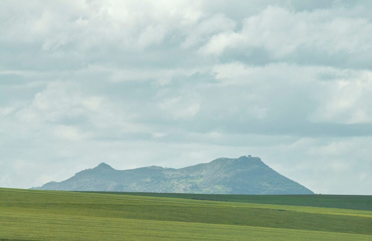
Where Sarasgad is a sharp spike above the temple town, Sudhagad is a broad, flat-topped fort with a big plateau to explore on top. It is one of the better-kept forts in this part of the Sahyadris, which is a large part of its appeal: trekkers come for the walk through forest and farmland, the atmospheric old buildings on the plateau, and the sense of space at the summit. Its manageable grade makes it a favourite for groups, families with older children and first-time fort trekkers, and the plateau is roomy enough that many people camp overnight.
Where is Sudhagad fort and how do you reach it?
Sudhagad fort is about 11 km east of Pali in Raigad, with the trek usually starting from the base village of Thakurwadi. Drivers from Mumbai or Pune reach it in roughly three to three and a half hours; by public transport, take a train to Karjat or Khopoli, a bus to Pali, and a local vehicle on to Thakurwadi.
The standard trailhead is Thakurwadi, the village at the base, from where the path climbs to the fort. By road, most visitors come off the Mumbai-Pune Expressway near Khopoli and drive via Pali, which sits about 35 km from Khopoli on the Khopoli-Pali road. Sudhagad is also about 26 km south of Lonavala and 53 km west of Pune, so it is reachable from several directions. On public transport, the common chain is a train to Karjat and on to Khopoli, a state transport bus to Pali, and then a shared or hired vehicle to Thakurwadi. Confirm the last-mile options locally, as village transport is limited.
How difficult is the Sudhagad trek and how long does it take?
The Sudhagad trek is generally graded easy to moderate and suits beginners with basic fitness. The main trail is commonly described as around three and a half kilometres and about two to three hours of climbing each way, with stone steps and a couple of iron ladders near the top; it is harder and slower in the monsoon.
For most of the way the path is a steady walk through forest and fields rather than a scramble, which is why it is recommended for newcomers. The adventure comes near the top, where sections of stone steps and a couple of fixed iron ladders help you up the steeper rock. Reported distances and times vary by source and pace, so treat the two-to-three-hour figure as a guide and allow extra for rests, photos and exploring the plateau. In the rains the forest trail turns muddy and the rock slippery, so progress slows and care is needed on the ladders and steps.
Why is Sudhagad considered one of the better-preserved forts?
Sudhagad is valued because its large plateau still holds well-kept old structures, temples and water tanks, with seasonal ponds and lakes forming in the monsoon. The combination of history, greenery and space to roam makes it one of the more rewarding forts to explore near Pali.
The plateau is the reason to linger rather than just tag the summit. You can wander among old gateways and buildings, visit the hilltop shrine, and see the stone water cisterns that supplied the fort. In the monsoon, parts of the top collect water into ponds and the whole hill turns lush and misty. The views stretch across the surrounding Sahyadri ranges and the Konkan countryside. Because the fort covers a large area and is reasonably maintained, a visit feels like a proper half-day of exploring rather than a quick in-and-out climb.
When is the best time to trek Sudhagad, and can you camp?
The best time to trek Sudhagad is the monsoon for green, misty scenery or winter, roughly November to February, for the most comfortable camping and clear views. The broad plateau makes Sudhagad a popular overnight camping fort, with an old wada and temple traditionally used for shelter.
Winter is the easiest season: dry trails, cool nights and long views make for comfortable walking and camping. The monsoon is the most beautiful, with waterfalls, cloud and green slopes, but trails are muddy and the ladders slippery, so it demands more care. Summer is doable if you start early and carry plenty of water. Camping on the plateau is a big part of Sudhagad’s appeal, and trekkers have long used the old hilltop structures for shelter; if you plan to stay overnight, carry your own gear, food and water, confirm any current rules locally, and leave the site exactly as you found it.
What should you carry and know before the Sudhagad trek?
For the Sudhagad trek carry plenty of water, food, sturdy shoes, a torch and a basic first-aid kit, since there are few facilities on the hill. Start early, take care on the iron ladders in the wet, consider a guide from the base for a first visit, and carry all waste back down.
A short checklist keeps the day safe and the fort clean.
- 1Water and food. There is no reliable shop on top, so carry enough for the whole trek and any overnight stay.
- 2Footwear and a torch. Shoes with grip for the steps and ladders, and a headtorch if you camp or start before dawn.
- 3Mind the ladders. The fixed iron ladders near the top need care, especially when wet in the monsoon.
- 4Guide for a first visit. A local guide from Thakurwadi helps with the route and timing if you do not know the fort.
- 5Leave no trace. Carry out all litter and respect the old structures and the hilltop temple.
FAQ
Where is Sudhagad fort and where does the trek start?
Sudhagad fort is about 11 km east of Pali in Raigad, Maharashtra, and the trek usually starts from the base village of Thakurwadi. Pali is about 35 km from Khopoli on the Khopoli-Pali road, and the fort is roughly 26 km south of Lonavala.
Is the Sudhagad trek easy or hard?
The Sudhagad trek is generally graded easy to moderate and suits beginners with basic fitness. Most of the route is a steady walk through forest and fields, with stone steps and a couple of iron ladders near the top; it is harder and slower in the monsoon.
How long does it take to climb Sudhagad?
The main trail is commonly described as around three and a half kilometres and about two to three hours of climbing each way, depending on pace and conditions. Allow extra time to explore the large plateau, and confirm current timings locally.
Can you camp on Sudhagad fort?
Yes. The broad plateau makes Sudhagad a popular overnight camping fort, and trekkers have traditionally used the old wada and temple for shelter. Carry your own gear, food and water, confirm any current rules locally, and leave no trace.
Can you combine Sudhagad with Sarasgad?
Yes. Sudhagad and Sarasgad near Pali are often called twin forts and sit a short drive apart, so many trekkers pair them over a weekend. Each is a separate climb, so plan an overnight stay to do both at a relaxed pace.
When is the best time to trek Sudhagad?
The monsoon offers green, misty scenery while winter, roughly November to February, gives the most comfortable camping and the clearest views. Monsoon trails are muddy and the ladders slippery, so take extra care if you go in the rains.
A weekend on forts like Sudhagad is how many people first fall for the Khopoli-Pali corridor – the green ridges, the old stone and the temple town below. Some come back looking for a plot of their own along the road, and Lords of the Lands knows this stretch of Raigad well.
Related reading
Plan your trip
- Ballaleshwar Ashtavinayak temple – the devotee-named Ganpati shrine at the heart of Pali.
- Sarasgad fort trek – the turban-shaped hillfort rising straight above the town.
- Trekking near Khopoli-Pali – the wider trail list across the corridor.
- Fort-hopping itinerary – how to string the area’s forts into one trip.
- Unhere hot springs – warm sulphur rock-cut pools near the Pali temple.
- Amba river nature – the quiet Konkan river country around Pali.
- Hidden gems of Pali and Sudhagad – lesser-known stops beyond the main sights.
- The Ashtavinayak route via Pali – fitting Ballaleshwar into the eight-temple circuit.
- Things to do in Pali – the temple, forts and springs of the Pali side.
- Things to do in Khopoli – the busier, Expressway end of the road.
- Places to visit around Khopoli-Pali – the full corridor sightseeing map.
- Imagicaa theme park, Khopoli – the big family day out near the Expressway.
- Family days out in Khopoli – easy outings for all ages.
- Waterfalls near Khopoli – monsoon cascades within easy reach.
Getting there
- Mumbai to Khopoli-Pali – routes and drive times from the city.
- Pune to Khopoli-Pali – the Expressway approach from Pune.
- Khopoli to Pali drive times – how long each leg of SH-93 really takes.
- Khopoli-Pali to the Navi Mumbai airport – distance and time to NMIA.
Land & investment nearby
- The complete Khopoli-Pali road land guide – the SH-93 corridor, survey by survey.
- Buying land in Pali in 2026 – prices and checks on the Pali side.
- Land near Ballaleshwar and Sarasgad – plots around the temple town.
- A weekend home on the Khopoli-Pali road – building a second home here.
- Khopoli land in 2026 – the Expressway-end land market.
- Weekend villa plot costs on SH-93 – what a build-ready plot really runs to.
Sources
Sudhagad (Bhorapgad) location about 11 km east of Pali, base village Thakurwadi, the plateau and its structures, and the stone steps and iron ladders on the route – public trekking guides and heritage records for Raigad. Distances, timings and trek grades vary by source and fitness and are given as a general guide only. Pali, Sarasgad, Lonavala and the Khopoli-Pali road (SH-93) distances – as described in the Lords of the Lands corridor guide. Trail and camping conditions change with the weather – confirm locally and trek responsibly. This guide is general travel information, not a safety certification.
